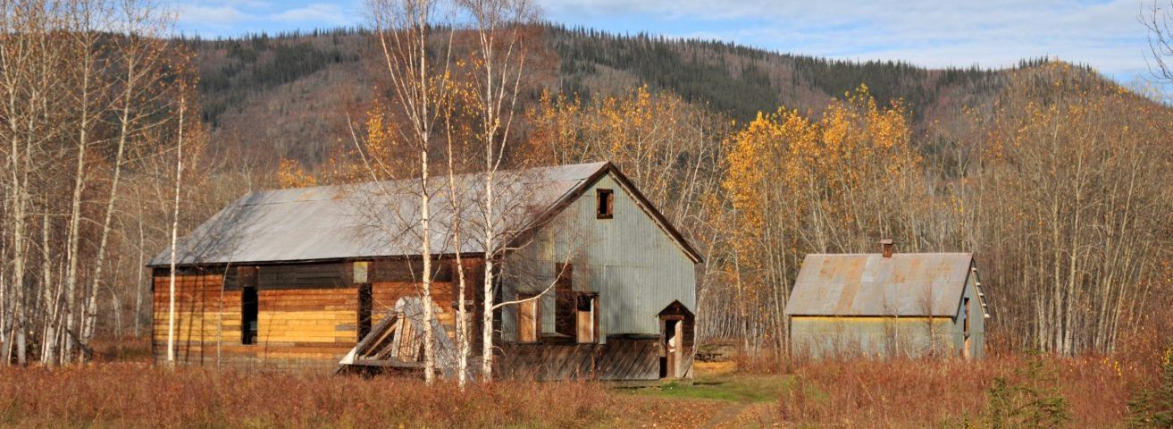
Chëdähdëk (Forty Mile)
Ch’ëdähdëk (Forty Mile) Forty Mile townsite is on the west bank of the Yukon River at the confluence of the Yukon River and the Fortymile River. The site is co-managed by Tr’ondëk Hwëch’in and Yukon governments.

First Nations people established camps along the soft flat banks near the river, awaiting the annual migrations of the Fortymile Caribou Herd that passed near here. They also fished for arctic grayling in spring and set up fish camps to catch and process salmon from two annual migrations up the Yukon River. Though only a small area of the site has been investigated, radiocarbon dating of materials excavated from six known archaeological components that predate our first contact with the outside world indicate that Ch’ëdähdëk was regularly used by First Nations for 2,400 years. In 1886, miners travelled up the Fortymile River drainage, staking mining claims on its tributaries in the fall and wintered over at the confluence of the Fortymile and Yukon rivers. The new community of Forty Mile had been established at Ch’ëdähdëk, over top of one of the Tr’ondëk Hwëch’in ancient hunting and fishing camps. By 1893, the town had a population of 600 people. The new town of log cabins became the Yukon’s first permanent non-Indigenous settlement.
There were six saloons, a roadhouse, grocery stores, a library, a theatre, restaurants and hotels, the Yukon’s first post office, and a telegraph office. Doctors, blacksmiths, and a dressmaker plied their trades here. Today, the townsite is no longer occupied and consists of an ensemble of seven historic log or timber buildings. There is also a pioneer cemetery southwest of the townsite with approximately 50 gravesites. The historic archaeological remains of this historic town are situated throughout the lower bench of the site. It was at Forty Mile where the relationship between the Tr’ondëk Hwëch’in and newcomers shifted from an egalitarian fur trade to a mineral- development economy. This shift is illustrated by the construction of the first colonial townsite in Tr’ondëk Hwëch’in territory over their ancient encampment. The views up and down the Yukon River remain unchanged. These vestiges of the once bustling town built over top of Indigenous camps demonstrate the impact of the expanding colonial efforts on the Tr’ondëk Hwëch’in way of life and lands.
Mission Island
Mission Island is a large sandbar island, located on the west side of the Yukon River near the southern limits of the historic Forty Mile townsite. Bishop Bompas and his wife Charlotte established a mission house and school here, for First Nations’ children, after the townsite of Forty Mile was established. This was also where many of the First Nations set up their cabins, caches, tents, and fish racks, where they could be nearby while their children learned in the school. This is an archaeological site and only building outlines of the mission school, the missionary residence, and former dwellings are what remain today.
The colonization of this small island demonstrates the impact on First Nations people of the early colonial efforts. The location of dwellings near the mission buildings and the location of their cemetery across the Yukon River show the increasing influence of the Church in the lives of Tr’ondëk Hwëch’in people as well as their segregation from the townsite, illustrating the increasingly marginal role in the community of the Tr’ondëk Hwëch’in. Yukon Government Historic Sites and Heritage Resources staff and Tr’ondëk Hwëch’in Heritage staff are responsible for seasonal conservation work and archaeology at the Forty Mile townsite. To protect the public’s safety, the site is currently closed until site infrastructure is installed and stabilization work on the historic structures is completed.
